Mobile Scanning: Rail Infrastructure
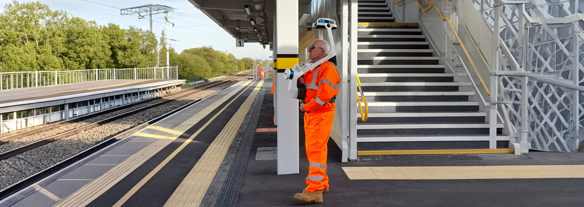
Mobile scanning or Simultaneous Localisation and Mapping (SLAM) technology provides a base for rapid data capture in the rail environment.
Why Lane & Frankham?
The use of NavVis/Ivion technology, combining rapid scan data collection with panoramic imagery, provides a far richer dataset than a traditional reconnaissance visit.
For example, a standard two-platform station can be fully captured in under half a day on-site. The resulting dataset can then be accessed by multiple team members to complete a wide range of tasks remotely, significantly reducing the need for “Boots on Ballast.”. The larger the asset captured, the greater the potential for both time and cost savings.
In addition to high-quality photographic imagery with options for mark-up, sharing, linking information, and taking general measurements, the dataset is supported by precise
point cloud data. This allows the creation of detailed CAD or Revit models.
Once captured, the data can be stored and revisited for a variety of applications without the need for repeated site visits. The imagery also provides a detailed snapshot in time,
which can be compared with subsequent surveys—even years apart—to monitor changes or assess asset condition.
Our Expertise
- Advice on specification and technology
- Data capture & post-processing
- Data hosting
- Post-production of CAD & Revit products from point cloud data
Contact Us