Our Geospatial & Modelling Services
We utilise the latest surveying technology, including fixed terrestrial laser scanners, mobile scanning, and drones, to provide a comprehensive suite of 2D and 3D geospatial products. We have extensive experience across a wide range of sectors, from commercial office spaces and public authority buildings to highly sensitive heritage assets.
Measured Building Surveys
We capture the exact dimensions and spatial relationships of your existing building asset, providing the foundational drawings required by your design and engineering teams.
- 2D plans, sections and elevations
- 3D architectural, structural and MEP models – delivered in industry stand formats – RVT, DWG, IFC and NWD
- 3D Point clouds and 360-degree imagery – interim deliverables which enable your design team to verify any assumptions made based upon as built information.
BIM Ready Surveys
Building Information Modelling (BIM) integrates precise geospatial data with rich, embedded asset information to create an intelligent digital model that supports every stage of your project.
- We work closely with you to define the exact level of detail and data your project requires – both for the current survey and for future development phases. This ensures your 3D model contains the right information at the right time.
- Through advanced, high‑accuracy scanning technology, we produce a complete digital representation of your asset. This forms a reliable, centralised database that enhances planning, design and long‑term asset management.
- We can model your asset from existing record drawings, As is, post strip and prior to final fixes installation, working side by side with your design team from early concept design through to hand over of asset information model AIR.
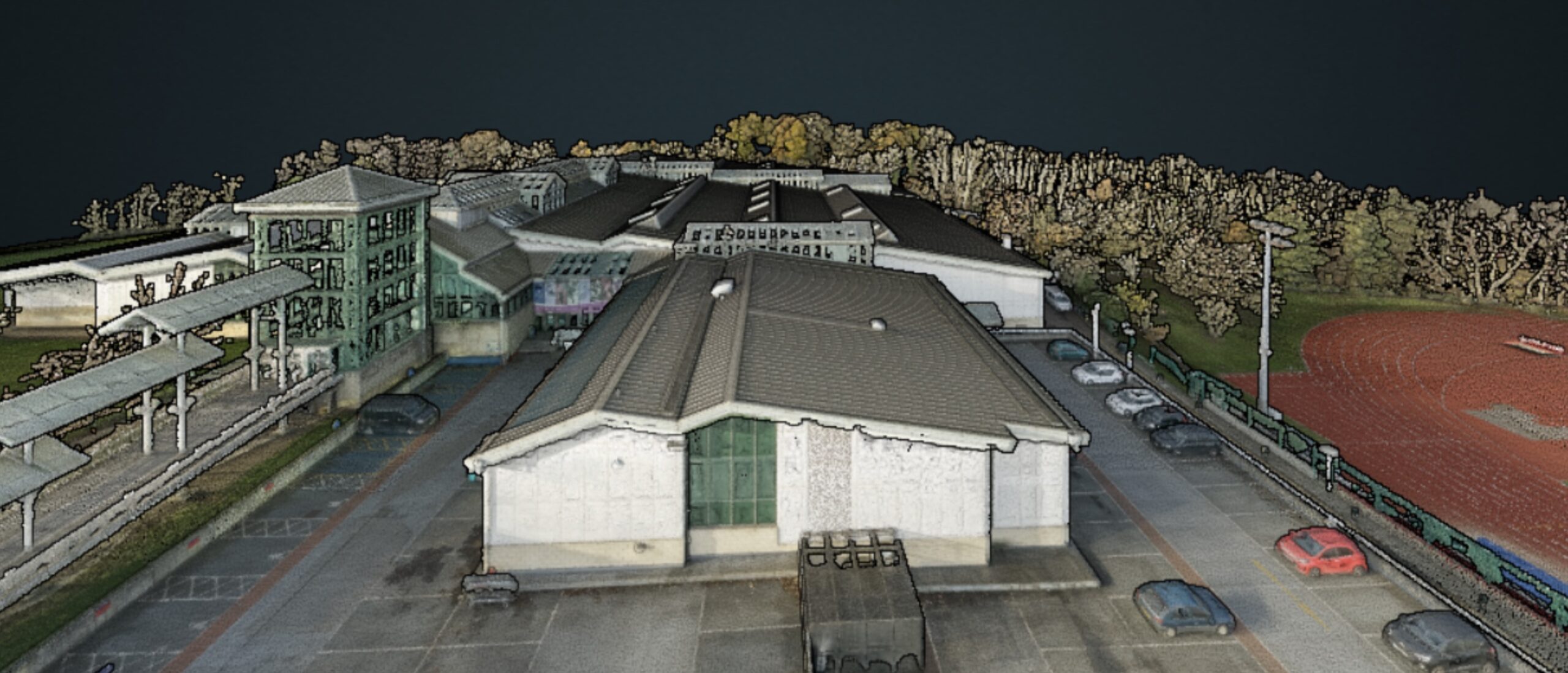
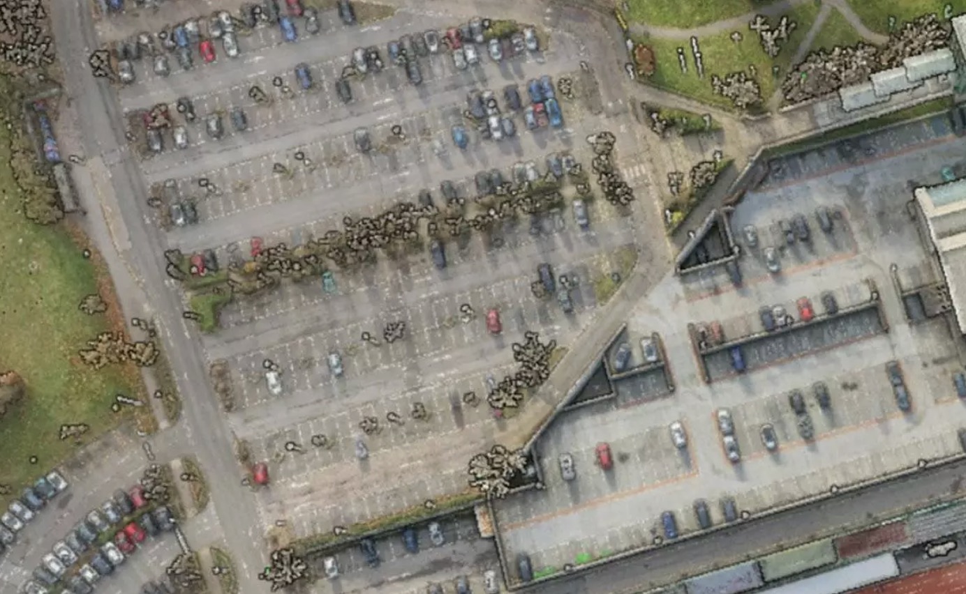
Laser Scanning
Laser scanning allows us to accurately and efficiently capture full 3D geospatial datasets of any asset, transforming how data is utilised across the project lifecycle.
- We rapidly capture large scale areas in a short space of time, minimising tenant disruption and operational downtime. This is especially practical during ‘small windows of opportunity’.
- We support monetary and time savings by scoping your survey brief to capture today’s priorities and tomorrows longer term aspirations. Measure once, use many times.
- Hazardous or hard to reach areas can be measured remotely, ensuring full data coverage whilst reducing risk.
Rights of Light (RoL) Modelling
- Precision data for specialists: we provide the highly accurate geospatial information from which RoL and Daylight Sunlight specialists perform their legal and spatial analysis.
- We can consider extending the scope of your site survey to include neighbouring assets that may be affected by your proposed design changes or new development. If we are already on site, the additional cost of capturing this data is minimal. We can efficiently scan and retain RoL elevations at this stage, enabling a 3D RoL model to be developed later if required. This proactive approach provides valuable flexibility, helping to de-risk your project and avoid unnecessary costs as the design progresses.
- We provide 3D solid CAD models, 3D Revit models and 2D elevations to the level of detail required to inform your ROL and DLSL analysis.
Meet our measured building and BIM surveys lead

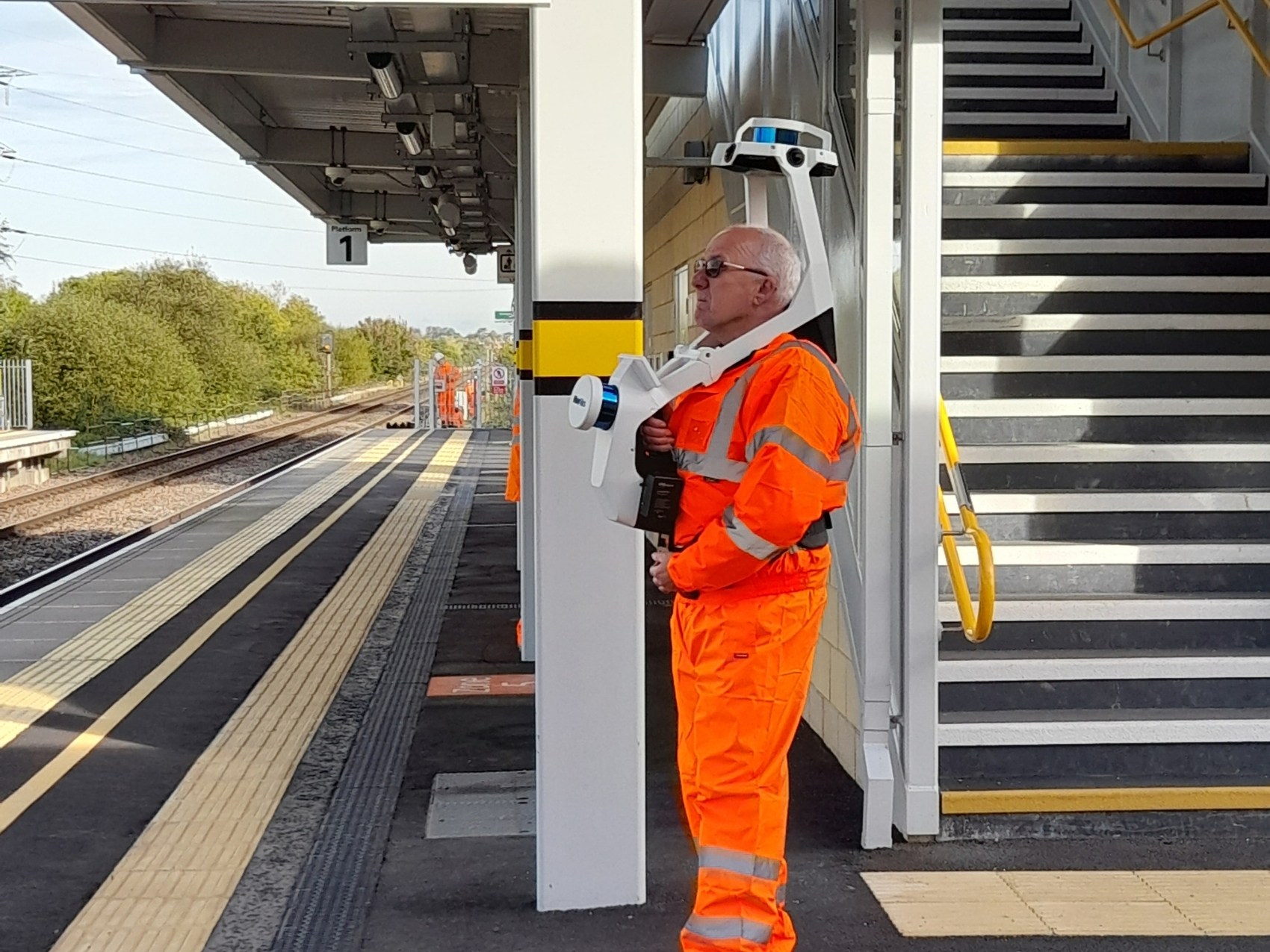
Mobile Scanning
Topographic Surveys and Utility Investigations
Area Referencing & Property Measurement
Our clients and partners
Trusted by developers, agents and heritage organisations