Lane & Frankham were instructed complete a 3D & 2D topographic survey of a significant length of road on two separate sites.
- Transport for London
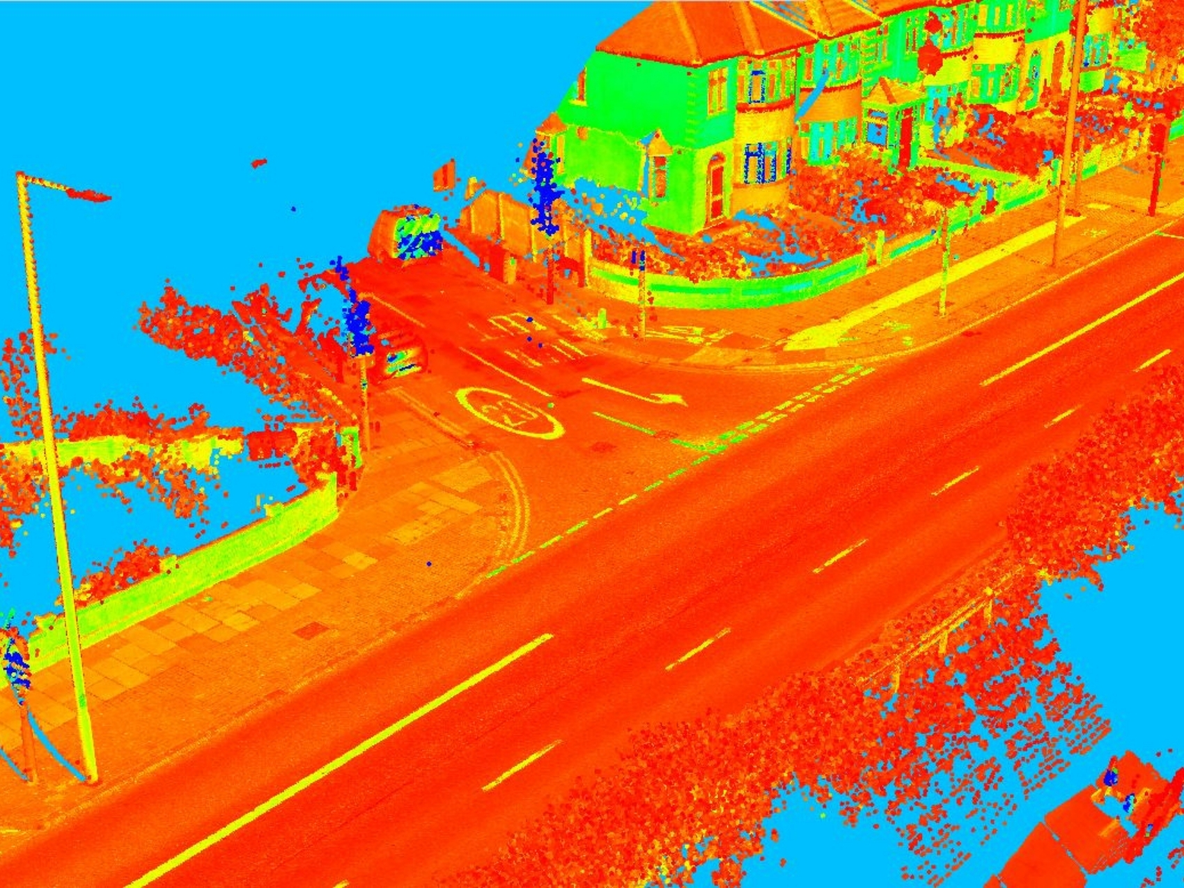
Upon award of the project it became clear that traffic management approach described at tender stage would not be achievable within the timeframes required for the project and that an alternative approach would be required.To this end we explored a mobile mapping solution.
Utilising a vehicle mounted scanning system, we were able to negate the need for traffic management. Although the mobile system is more costly to deploy, by offsetting against the cost of traffic management and driving both the A10 and A2 sites in a single shift, we were able to carry out the data capture works within the original budget while maintaining all the safety considerations paramount to working within a highway environment.
Having created a raw dataset form the mobile mapping in association with ground based GPS observations, we were able to complete all further works from the office environment. We were able to extract critical data from the point cloud and produce work in progress models based on the client priorities, building up to the final comprehensive deliverable.
Being proactive in adapting quickly to the changing situation allowed us to continue to deliver the product initially instructed in a timely and comprehensive manner without having to compromise on quality or content.